 In Development
Geospatial Analytics / Sustainability
Solar Waste Forecasting Dashboard
An interactive spatial platform exploring photovoltaic installation trends and potential future solar panel waste patterns.
Cartography / Interactive atlas
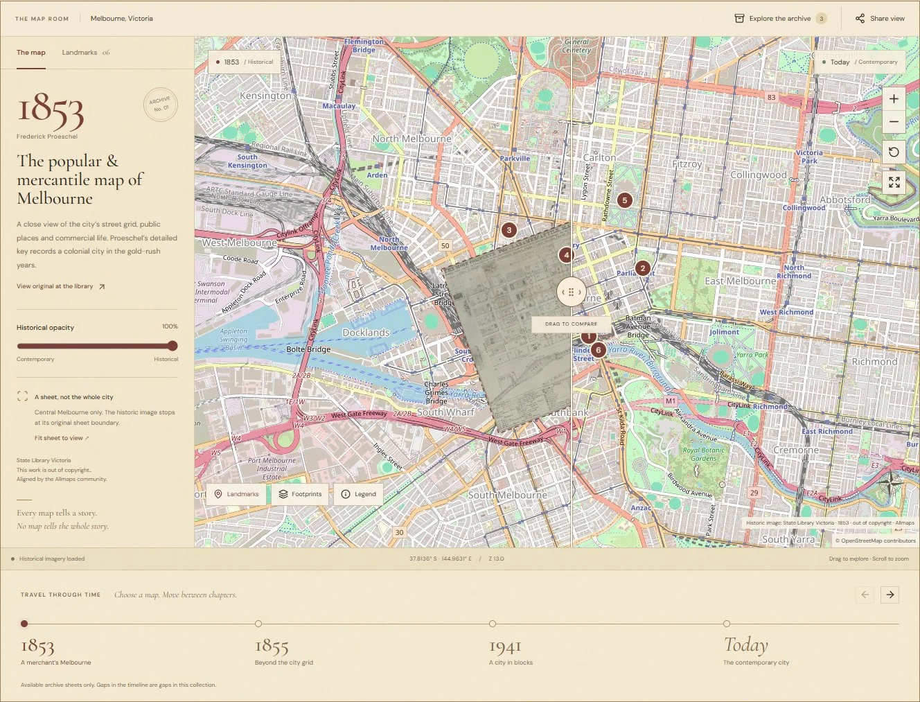
Created for 30DayMapChallenge 2026, Day 06 — Vintage, Melbourne Through Time brings genuine State Library Victoria maps from 1853, 1855 and 1941 into a contemporary web map. Visitors can move between archival sheets, drag the comparison divider, adjust historical opacity and explore present-day landmarks. Shareable views preserve the selected map, location, zoom and comparison settings.
Bring archival maps into a contemporary web interface while retaining provenance and communicating approximate historical alignment.
Connect State Library Victoria imagery with Allmaps georeferencing. Synchronise archival and contemporary maps using a comparison divider, opacity controls, an accessible timeline and shareable views.
In DevelopmentGeospatial Analytics / Sustainability
An interactive spatial platform exploring photovoltaic installation trends and potential future solar panel waste patterns.
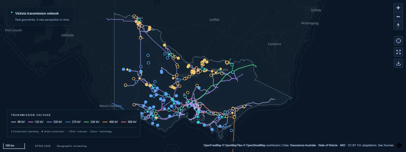 Live infrastructure explorer
Energy / Spatial analysis
An interactive dashboard exploring Victoria’s electricity network, renewable energy and battery storage sites through spatial proximity analysis.