 Live infrastructure explorer
Energy / Spatial analysis
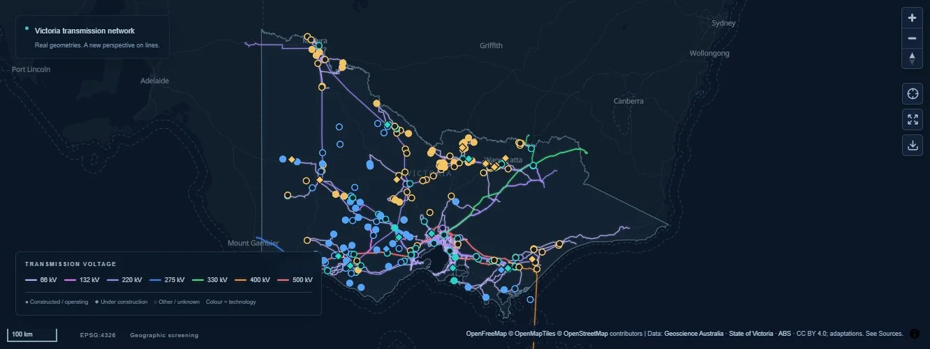
Victoria Grid Opportunity Explorer
An interactive dashboard exploring Victoria’s electricity network, renewable energy and battery storage sites through spatial proximity analysis.
Geospatial Analytics / Sustainability

An in-development exploration of the relationship between solar adoption, geography and future material recovery needs. The intended dashboard brings installation trends and exploratory waste scenarios into a shared spatial view.
Photovoltaic installations have a geographic footprint and a life cycle. Exploring their potential future waste patterns means bringing different data sources and assumptions together while clearly communicating uncertainty.
The development direction combines spatial data preparation, installation trend mapping and scenario-based visualisation. The interface is intended to help people explore patterns and understand the assumptions behind them. Forecast methods, data coverage and validation remain part of the ongoing work.
Live infrastructure explorerEnergy / Spatial analysis
An interactive dashboard exploring Victoria’s electricity network, renewable energy and battery storage sites through spatial proximity analysis.
 Live satellite data explorer
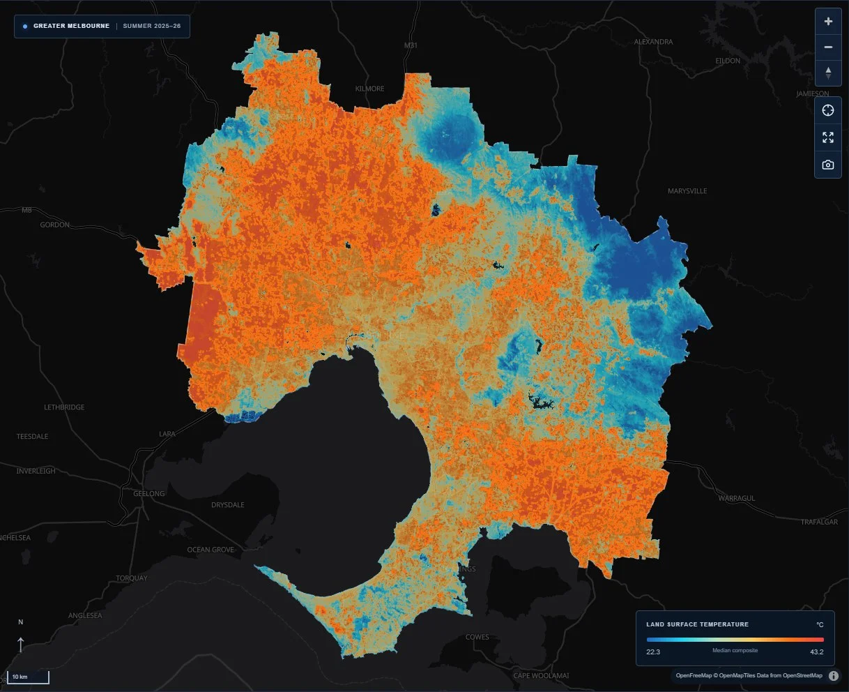
Remote sensing / Urban climate
A satellite-based Web GIS exploring surface heat clusters, cool zones and urban greenery across Greater Melbourne.