 In Development
Geospatial Analytics / Sustainability
Solar Waste Forecasting Dashboard
An interactive spatial platform exploring photovoltaic installation trends and potential future solar panel waste patterns.
Energy / Spatial analysis
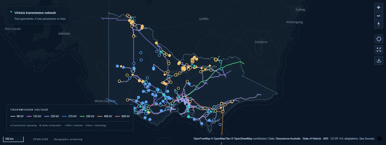
Created for 30DayMapChallenge 2026, Day 2 — Lines, this explorer connects transmission and subtransmission line geometry with renewable energy and battery storage site records. Visitors can filter infrastructure by voltage, technology and source status, inspect minimum distances from facility points to line segments, and calculate dissolved corridor buffers. Searchable results, charts and exports connect the map with its underlying evidence.
Make infrastructure proximity understandable while keeping geographic screening distinct from network capacity or connection feasibility.
Combine attributed network and facility records with point-to-line measurements and dissolved corridor buffers. Connect map filters, searchable results, charts and exports so visitors can inspect the underlying evidence.
In DevelopmentGeospatial Analytics / Sustainability
An interactive spatial platform exploring photovoltaic installation trends and potential future solar panel waste patterns.
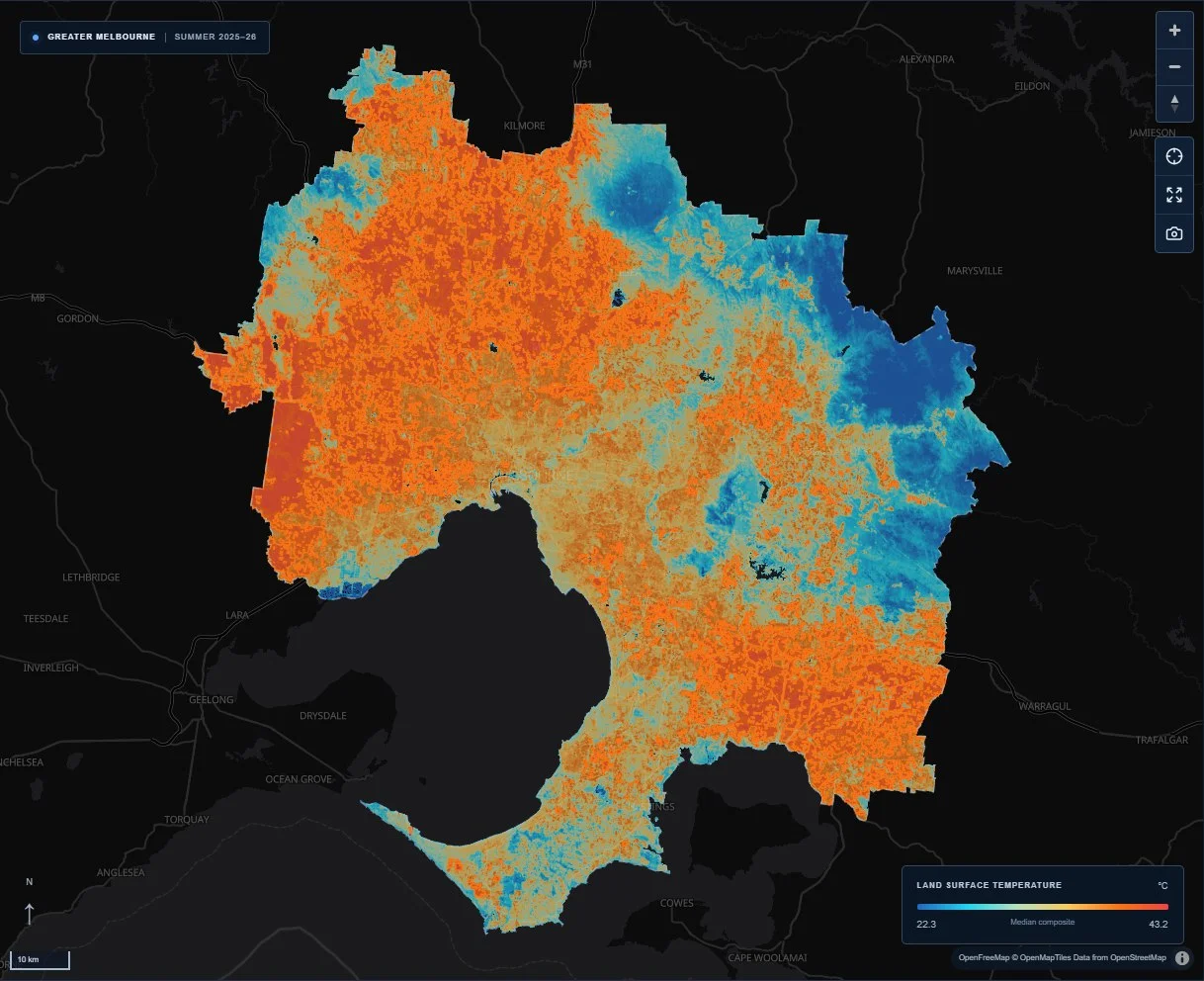 Live satellite data explorer
Remote sensing / Urban climate
A satellite-based Web GIS exploring surface heat clusters, cool zones and urban greenery across Greater Melbourne.